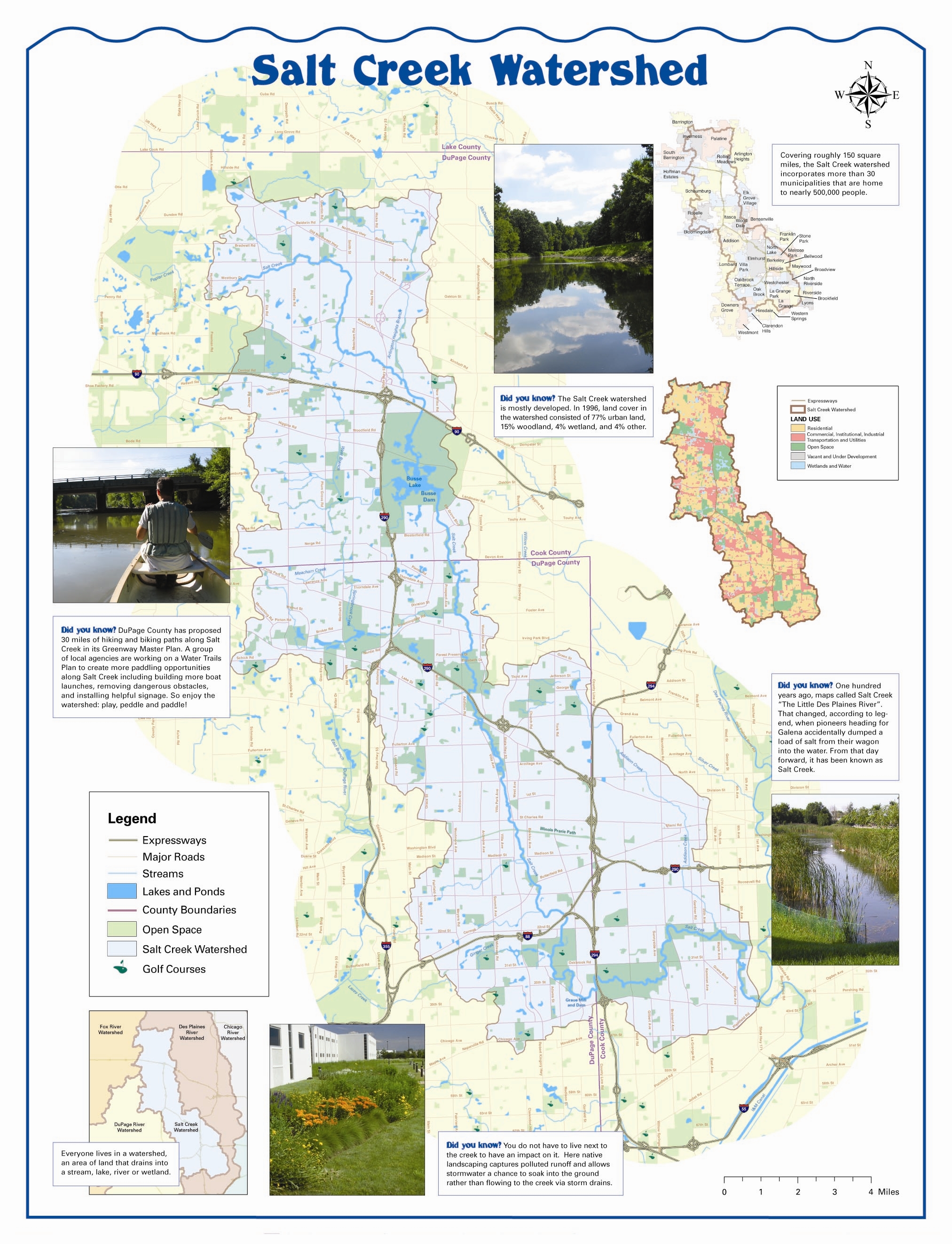
We all live in a watershed!
A watershed is the area of land that drains into a particular body of water. Where one watershed ends, another watershed begins. The Salt Creek Watershed is bounded by the Des Plaines River watershed on the east, and the DuPage River watershed and the Fox River watershed on the west. View a detailed Salt Creek watershed map.

All watersheds are connected. The Salt Creek and the DuPage River are part of the Des Plaines River watershed. The Des Plaines River is in the Illinois River watershed, and the Illinois River is in the Mississippi River watershed. The Mississippi River is in the Gulf of Mexico watershed.

Map generated using the USGS's Streamer
Note: Streamer is a USGS interactive map. Choose any point
in the U.S. to see how water flows from there to the oceans.
If you want to protect the Mississippi estuary and the Gulf of Mexico, start in your own back yard. There are things you can do to improve the water quality of the Salt Creek, and that improves water quality all the way to the Gulf of Mexico.